The integration of GPS technology in smartphones and the seamless functionality of Google Maps have transformed how we navigate the world. Whether you’re exploring a new city, heading to a business meeting, or simply trying to find the nearest café, this combination provides precise location services and real-time navigation.
But how exactly does the GPS in smartphones interact with Google Maps to offer such accurate services? Let’s break it down step by step, starting with an understanding of the fundamental technologies at play.
1. Understanding GPS: The Backbone of Location Services
Global Positioning System (GPS) is a satellite-based navigation system developed by the U.S. government, initially for military purposes. Over time, it became available for civilian use and is now integrated into many devices, including smartphones. GPS works by communicating with a network of satellites orbiting Earth. Your smartphone’s GPS receiver picks up signals from at least four satellites to triangulate your exact location.
Each satellite transmits a signal with a timestamp and its precise orbital position. Your device calculates the time delay between sending and receiving the signal, determining its distance from the satellite. By combining data from multiple satellites, your smartphone can pinpoint its position with remarkable accuracy.
- Advertisement -
GPS in Smartphones:
The GPS chip inside smartphones is miniaturized but works similarly to larger navigation systems. With the aid of accelerometers, gyroscopes, and magnetometers, modern smartphones can detect even minute changes in movement and orientation, offering smooth transitions in navigation apps like Google Maps.
2. The Role of Google Maps: More Than Just Navigation
Google Maps is one of the most sophisticated mapping and navigation tools available today. But it’s more than just a simple map. It incorporates a wide range of data, including satellite imagery, traffic updates, real-time location sharing, business directories, and user-generated content like reviews and photos.
Google Maps does not rely solely on GPS data. It uses a combination of several location services to increase accuracy. Along with GPS, Google Maps pulls data from Wi-Fi networks, cell towers, and Bluetooth beacons to estimate your location.
How Google Maps Enhances GPS:
- Map Matching: Google Maps corrects GPS errors by ‘snapping’ your position to known roads or paths. This is especially helpful in urban areas with high buildings or interference where GPS might be less accurate.
- Route Optimization: It not only provides directions but also helps users by suggesting optimal routes based on real-time data, such as traffic conditions, road closures, and estimated travel times.
- Layering: Google Maps combines multiple data sources like street view, traffic data, and satellite images to provide a holistic view of your surroundings.
3. GPS and Google Maps: The Interaction
When you open Google Maps and request directions or search for a place, here’s what happens behind the scenes:
Step 1: Location Detection
As soon as you open Google Maps, the app initiates a request for your current location. Your smartphone’s GPS system communicates with satellites to determine your coordinates. However, GPS alone can take time to provide an accurate fix, especially if you’re indoors or in densely populated areas. To speed up this process, Google Maps combines data from other location services like Wi-Fi networks and cell tower triangulation to estimate your location more quickly.
Step 2: Data Aggregation and Mapping
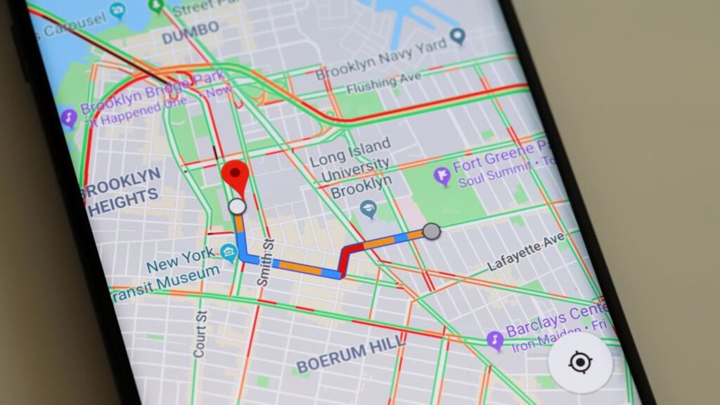
Once Google Maps has your coordinates, it cross-references this data with its vast map database. The system automatically snaps your location to the nearest street or landmark. It takes into account the accuracy range reported by the GPS system—often indicated by a blue circle around your location marker.
Step 3: Route Calculation
When you search for a destination or request directions, Google Maps calculates the best route using a combination of GPS data, real-time traffic information, and historical traffic patterns. It offers multiple route options, along with estimated travel times, and continuously updates the route based on live traffic updates.
Step 4: Real-Time Updates
As you move, your smartphone’s GPS continues to send location updates to Google Maps. The app constantly recalibrates your position, ensuring you stay on the correct path. If you take a wrong turn or encounter unexpected traffic, Google Maps will adjust the route in real time.
4. Enhanced Features: Beyond Basic Navigation
Google Maps offers several advanced features that make it stand out from traditional GPS systems. Here’s how they interact with your smartphone’s GPS:
a) Turn-by-Turn Navigation with Voice Commands
Using GPS data, Google Maps can guide users with voice commands, alerting them of upcoming turns or changes in the route. The app’s voice assistant draws data from your phone’s sensors (like the compass) to detect orientation, making navigation easy without having to look at the screen.
b) Real-Time Traffic Monitoring
Google Maps uses GPS data from millions of users to provide real-time traffic updates. When multiple smartphones report slow movement in a specific area, Google Maps infers that there’s traffic congestion and updates routes accordingly. This user-generated data allows the app to offer alternative routes to avoid delays.
c) Location Sharing
With Google Maps, users can share their real-time location with friends or family. The GPS on your phone continuously updates your location, and Google Maps sends this data to selected contacts via its server. It’s a useful feature for safety, meetups, or tracking travel progress.
d) Offline Maps
GPS functionality doesn’t require an internet connection, which is why Google Maps offers the option to download maps for offline use. Even without a network connection, GPS continues to function, allowing you to use navigation in areas with poor cell reception or when you’re in airplane mode.
5. Accuracy and Challenges: GPS Limitations
Although GPS technology is incredibly powerful, it is not without its limitations. Some factors that can affect the accuracy of GPS include:
- Obstructions: Tall buildings, trees, tunnels, and indoor spaces can interfere with satellite signals, leading to less accurate location fixes.
- Atmospheric Conditions: Weather conditions like heavy clouds or storms can also degrade the signal quality.
- GPS Drift: In some instances, especially in dense urban areas (known as “urban canyons”), GPS signals can bounce off buildings, leading to inaccuracies known as GPS drift.
6. How Google Overcomes GPS Challenges
Google Maps addresses many of these limitations by integrating data from additional sources:
a) Assisted GPS (A-GPS)
To improve the performance of GPS, especially in challenging environments, Google Maps uses A-GPS, which combines satellite data with information from local cell towers and Wi-Fi networks. This results in faster location fixes and more accurate positioning.
b) Machine Learning and Data Analytics
Google leverages machine learning to analyze vast amounts of location data. By understanding common traffic patterns and GPS errors, Google Maps can predict and correct errors even before they occur.
7. Privacy Considerations: Balancing Convenience with Security
While GPS and location services are convenient, they raise important privacy concerns. Google Maps and smartphones provide options for users to control how and when their location data is used. Some key privacy features include:
- Location History: Users can choose to enable or disable the recording of their location history. When enabled, Google Maps can provide personalized recommendations based on past visits.
- Incognito Mode: Google Maps offers an incognito mode where your location activity isn’t saved to your Google account, giving users more privacy.
Conclusion: The Symbiotic Relationship Between GPS and Google Maps
The interaction between smartphones’ GPS systems and Google Maps is a prime example of how modern technology can enhance daily life. By combining satellite-based GPS with various data sources, Google Maps provides an accurate, real-time navigation experience. Whether you’re navigating through busy city streets or exploring remote landscapes, this technology ensures you reach your destination efficiently and safely.
With continuous advancements in GPS accuracy, data integration, and real-time updates, we can expect even more seamless and precise location services in the future. The integration of augmented reality, indoor mapping, and other cutting-edge technologies could further elevate the role of GPS and Google Maps in our lives.